Early Land Use

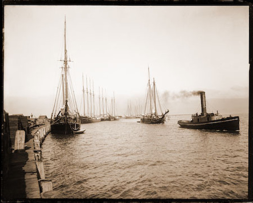
Figure 1: Arcata Wharf, 1893 [1].
The land between the Bay and the forested hillsides was primarily marshland prior to the 1860’s. In the early 1850’s European settlers saw the potential for a port and re-provisioning center for the gold mines. They came to the Bay with the hopes of striking it rich by gold mining the nearby Klamath, Trinity, and Salmon Rivers [1]. This was the perfect place to build an infrastructure that could handle the incoming commerce.
Union Plank Walk and Rail Track Company completed the construction of a wharf and railroad in 1855. The wharf was to run from the Plaza and about two miles into the Bay. It's purpose was to allow cargo vessels to unload at anytime during the tide and to connect Arcata to shipping channels. In addition to the wharf, about 20 miles of railroad were laid, the first railroad in California [1]. After only 20 years of completion, the wharf was extended due to the build up of deposited sediment from the Mad River Canal, which was used for lumber transportation.
Union Plank Walk and Rail Track Company completed the construction of a wharf and railroad in 1855. The wharf was to run from the Plaza and about two miles into the Bay. It's purpose was to allow cargo vessels to unload at anytime during the tide and to connect Arcata to shipping channels. In addition to the wharf, about 20 miles of railroad were laid, the first railroad in California [1]. After only 20 years of completion, the wharf was extended due to the build up of deposited sediment from the Mad River Canal, which was used for lumber transportation.
1855: Logging

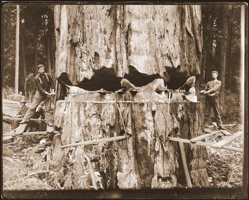
Figure 2: Falling a 15 foot diameter redwood, 1900 [2].
The booming timber industry prompted more development and heavy use of the wharf. The discovery of the “red gold,” or the redwoods encouraged the growth of the shipping industry in the Bay. Mills were constructed all around the Bay to maximize the harvest of the redwoods. Although the wharf was initially constructed for the export of gold, the primary business soon became the exportation of lumber [4].
The wharf was used heavily until the construction of the railroad to San Francisco in 1914. At this time, shipping activity decreased as the railroad could handle all of the goods by train, the wharf was abandoned [3].
The wharf was used heavily until the construction of the railroad to San Francisco in 1914. At this time, shipping activity decreased as the railroad could handle all of the goods by train, the wharf was abandoned [3].
1945: More Logging
In 1945 the land of the Arcata Marsh became active again. A concrete deck was constructed for storage use by two lumber mills. Where the George Allen Enhancement Marsh now lies, lumber was stored, and at the location the mills operated, the Arcata Marsh Interpretive Center now stands . A nine-acre pond was also developed to further accommodate the demands of the two lumber mills. The mills closed in the 1960’s, and the two abandoned lumber mills were donated to the city [5].
1964: The Landfill

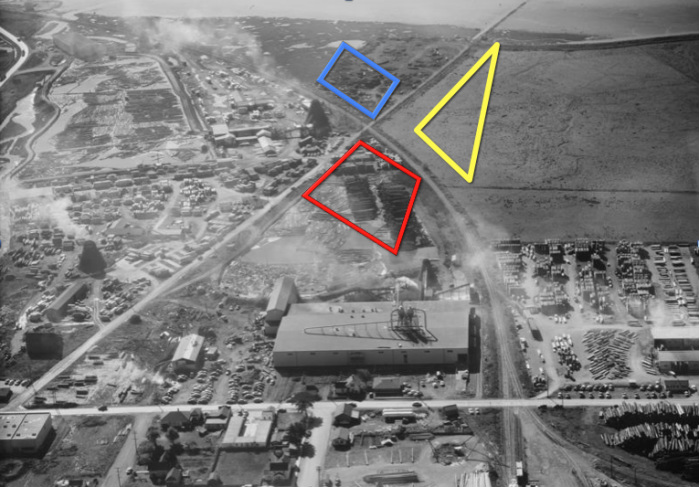
Figure 3: Arcata Plywood mill situated on the land of the marsh, 1952 [3].
Area in... blue: approximate location of Mt. Trashmore; yellow: approximate location of Hauser Marsh; red: approximate location of Gearheart Marsh.
The city saw the site as a potential area for industrial development. The land needed to be filled because the marshes were below sea level. In 1965, the Arcata Bay was drained and diked in order to create a landfill in the site of the present marsh project [6]. The newly capped mound of trash was coined “Mount Trashmore” [4,5,6]
In 1973 the 40-acre landfill was condemned, closed, and “capped” with mud by the Department of Health as an alternative to conducting an Environmental Impact Report. At this time health concerns were raised due to the leachate that was seeping into the Bay. At this time primary wildlife consisted of rats, cats and glaucous wing gulls. The Caspian tern nesting area that is nearby was depredated due to the gulls and there were reports of owls burrowing in the landfill [6]. Proposals for the area of the landfill included a golf course, baseball field, motor-cross area, or a nature center. The nature center was chosen and the marsh restoration planning began.
In 1973 the 40-acre landfill was condemned, closed, and “capped” with mud by the Department of Health as an alternative to conducting an Environmental Impact Report. At this time health concerns were raised due to the leachate that was seeping into the Bay. At this time primary wildlife consisted of rats, cats and glaucous wing gulls. The Caspian tern nesting area that is nearby was depredated due to the gulls and there were reports of owls burrowing in the landfill [6]. Proposals for the area of the landfill included a golf course, baseball field, motor-cross area, or a nature center. The nature center was chosen and the marsh restoration planning began.
Go To...
History
Land
Wastewater Treatment
Restoration and Wastewater Treatment Plan
Current Operations and Land Use
Benefits
References
Land
Wastewater Treatment
Restoration and Wastewater Treatment Plan
Current Operations and Land Use
Benefits
References
